
Mapline Informatics (Brand: mapWINGS) brings you ready to refer Printed-MAPS (not to scale) of States of India and the World. Maps are available on mapwings.com and amazon.in (keyword – mapWINGS)
mapWINGS provide Accurate and Professional maps suitable for students, office goers, sales/marketing/field professionals and map-enthusiasts looking for maps for educational and information purposes. Rolled & Packed professionally in a reusable 4 mm thick, 13-27 inch length, PAPER PACKAGING TUBE or TUBE MAILER for map safety and withstanding all kinds of shipping stress.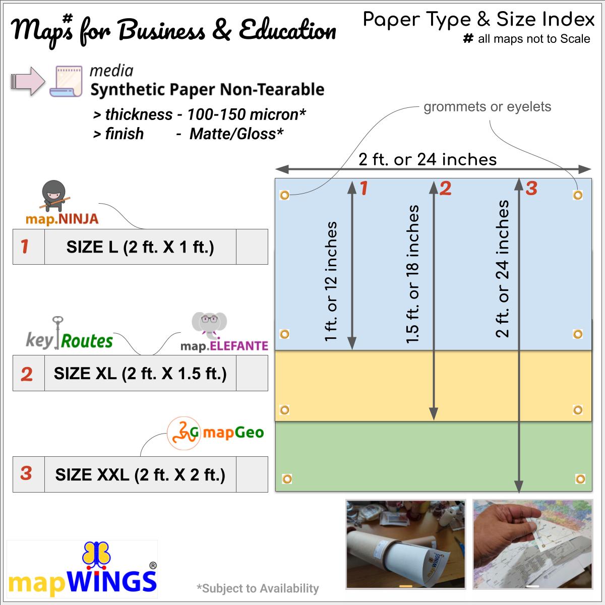
Maps are printed on Tear Resistant Synthetic Paper (150-250 micron), providing durability, clarity and quality to cartography for business.
All Maps provide admin boundaries (country-state-districts) subject to availability and bring forward Road and Rail network along with important Locations (India-Population defined data).
Sample Listing*
Map of districts of | state of {STATE NAME} | with with Population classified Towns and Locations, Highways (including NH#), Rail and State/District Boundaries with informative map-Legend and Map-Index. The map is printed on Tear-Resistant SYNTHETIC PAPER of Superlative Quality clarity, full color and long life. Size 24 X 12 inches or 2 ft X 1 ft (A3+).